
Technology·News & analysis
MapQuest's new Surveillance Layer shows where license plate readers are
A free toggle in the MapQuest app puts known license plate readers and outdoor cameras from Flock Safety and a dozen other brands on the map.
Tide
Ripple
Sci-fi
3/10
Reality
In your hands
Your map app now draws little eyeballs where the cameras are.How we rate
MapQuest added a Surveillance Layer to its app that shows known license plate readers and outdoor cameras.
It covers Flock Safety plus more than ten other brands, from Motorola Solutions to Verkada, with an eyeball icon for each location. Flock alone has deployed more than 100,000 cameras across the US, CarScoops reports. MapQuest hasn't said where the data comes from, and the map only shows cameras that someone has already found.
What to know
- MapQuest added a Surveillance Layer to its app that shows known license plate readers and outdoor surveillance cameras.
- It covers Flock Safety plus brands like Motorola Solutions (Vigilant), Genetec, Axis Communications, Axon, Leonardo (ELSAG), Neology, Rekor, PlateSmart, Ubicquia and Verkada.
- You switch it on in Map Options, next to the traffic and incidents layers, and each camera shows up as an eyeball icon.
- MapQuest hasn't said where the data comes from; Gizmodo says it looks like the crowdsourced DeFlock and OpenStreetMap data.
MapQuest has added a Surveillance Layer to its app that shows where known license plate readers and outdoor cameras stand. MapQuest announced it on October 15 with four words: "The Roads Have Eyes!"
So what does it actually show, where does the data come from, and why is a map app from 1996 suddenly in the middle of a very 2026 conversation?
What did MapQuest add?
The new layer puts known license plate readers and other outdoor surveillance cameras on the MapQuest map. You turn it on in Map Options, the same menu that holds the traffic and road incidents layers, Gizmodo and The Next Web report.
LiveNOW from FOX reports that each location shows up as an eyeball icon. Tom's Hardware adds that the layer shows the direction each camera faces, not just where it stands.
MapQuest's own list of brands on the map is long:
- Flock Safety, one of the largest makers of license plate readers in the US, according to The Next Web
- Motorola Solutions (its Vigilant line)
- Genetec, Axis Communications and Axon
- Leonardo (its ELSAG readers)
- Neology, Rekor, PlateSmart, Ubicquia and Verkada
- "Other outdoor surveillance cameras," in MapQuest's words
The feature arrived in a Halloween-themed update. MapQuest teased it for days on social media with posts like "Things are about to get spooky" and "Ever feel like somebody's watching you?" The same update also brought spooky-season versions of MapQuest's Questies.
"The Roads Have Eyes! Turn on the Surveillance Layer in Map Options to see known license plate readers from Flock Safety, Motorola Solutions (Vigilant), Genetec, Axis Communications, Axon, Leonardo (ELSAG), Neology, Rekor, PlateSmart, Ubicquia, Verkada, and other outdoor surveillance cameras."
On October 17, MapQuest followed up with a short how-to post on turning the layer on.
In real life Update the MapQuest app, open Map Options and flip on the Surveillance Layer. Then look at your usual route to work. The eyeballs you see are cameras someone has already spotted and mapped.
First, what is a license plate reader?
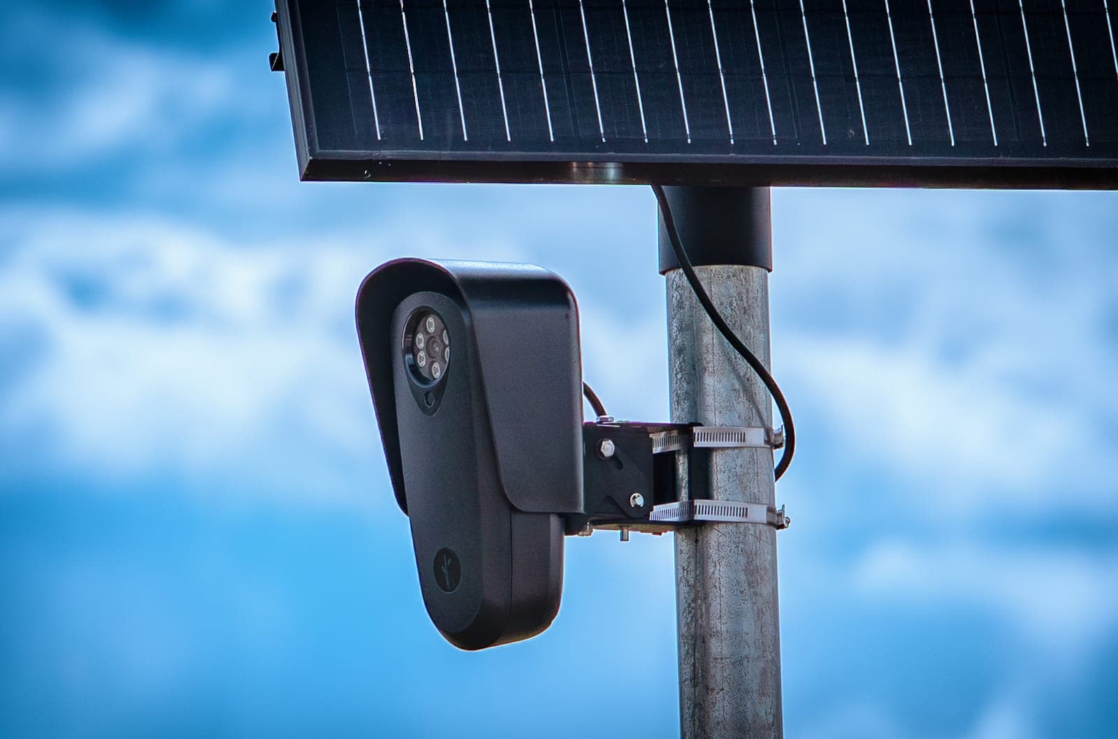
A license plate reader is a camera built to read the plates of passing cars. The industry calls it ALPR, short for automatic license plate recognition.
The OpenStreetMap wiki explains the basics. The camera uses computer vision, software that "reads" images, to find plates in the traffic it films. Some systems also log the color, make and model of each car. Many models have infrared lights so they can work at night.
The Next Web describes what happens next. The camera logs each plate with the time and place it was seen. Police and private groups can then search those records.
Think of it like a guest book at the entrance of every street. You never sign it yourself, but the camera writes your car's name in it anyway, with the time.
Where does MapQuest get the locations?
MapQuest hasn't said. Gizmodo reports it reached out to the company and was waiting for an answer.
Gizmodo points out that the data looks similar to DeFlock, a grassroots project that keeps a user-submitted map of license plate readers. It says MapQuest may be drawing on DeFlock and the OpenStreetMap project, the free, volunteer-built map of the world.
That theory makes sense if you look at how OpenStreetMap works. It has a dedicated tag for these devices, "surveillance:type=ALPR," with extra tags for the brand, the direction a camera faces and whether it watches a street or a parking lot.
CarScoops, citing ABAB News, reports that the locations in MapQuest are crowdsourced, so users can add cameras they spot.
The catch: a crowdsourced map is only as complete as the people who build it. A camera nobody has reported won't show up. And Tom's Hardware notes the obvious limit: if your destination is covered by cameras, you'll pass one anyway.
Why are these cameras in the news?
License plate readers have spread quickly across the US. CarScoops reports that Flock alone has deployed more than 100,000 cameras in the country.
Supporters point to real results. Flock says its cameras help police solve crimes and find missing people. LiveNOW from FOX reports they have helped find missing seniors, catch car thieves and provide evidence in high-profile criminal cases.
Critics point to privacy. Here's what the reporting around the launch adds:
- Contracts: more than 50 agencies or jurisdictions have canceled, suspended or rejected a contract, or switched cameras off, since the start of the year, according to a DeFlock tracker cited by LiveNOW from FOX.
- Misuse: The Washington Post found nearly 50 cases of police officers charged with or accused of using the cameras for unauthorized purposes, LiveNOW from FOX reports.
- Mistakes: Tom's Hardware mentions administrative errors, including one that led to an innocent car reviewer being detained.
Tom's Hardware also reminds readers that police departments complained back in 2015, when Waze let drivers report where officers were. How police will react to a camera map is unclear.
Why is it MapQuest doing this?
If you're old enough, you remember MapQuest as the site you used to print driving directions. It launched in 1996, and AOL bought it for $1.1 billion in 2000, CarScoops reports. Then Google Maps and Waze took over, and MapQuest faded into the background.
This year it came back into the headlines. When Google Maps and Apple Maps changed the name of Lake Ontario on their US maps after an official naming update, MapQuest kept the old name. The Next Web reports MapQuest downloads jumped in September after that decision, and Gizmodo says the app hit the top spot in Apple's App Store.
MapQuest is turning a renewed spotlight into features the bigger map apps don't have. Engadget notes it recently added Android Auto support and public transit directions. The Surveillance Layer is the latest, and CarScoops points out it's something you won't get alerts for on Google Maps or Waze.
It's a little like a band from the 90s getting back together and opening with a song nobody else will play.
How is it different from DeFlock's own map?
DeFlock already runs a public map of license plate readers, built from user reports. The difference is mostly about where you see it.
| DeFlock map | MapQuest Surveillance Layer | |
|---|---|---|
| What it is | A dedicated camera map | A layer inside a full navigation app |
| Where the data comes from | User reports | Not disclosed (likely similar crowdsourced data) |
| Directions and traffic | No | Yes |
| Cost | Free | Free |
Why it matters: a dedicated website reaches people who already go looking for it. A switch in a navigation app reaches people who were only planning their drive to the store.
What it means for you
- You can see it today: update the MapQuest app and turn on the Surveillance Layer in Map Options. It's free.
- It isn't a complete list: only cameras someone has already spotted and mapped appear, and new ones go up all the time.
- It won't make you invisible: many destinations have cameras on every way in, so the map tells you where they are more than how to avoid them.
- You can help fill it in: the locations are crowdsourced, so a camera you spot on your street can end up on the map.
The bottom line
MapQuest turned a public debate into a simple switch: tap it and you see where license plate readers and outdoor cameras are. The data comes from people who reported them, so it's useful but not complete. For a map app most people last used in the age of printers, it's a surprisingly modern feature.
Key facts
- Feature
- Surveillance Layer in the MapQuest app
- Announced
- October 15, 2026, on MapQuest's social accounts
- Where to find it
- Map Options, next to traffic and incidents
- Brands covered
- Flock Safety and 10+ other camera makers
- Price
- Free, part of the MapQuest app
Got questions?
Quick answers, plain wordsWhat is MapQuest's Surveillance Layer?
It's an optional map layer in the MapQuest app that shows the locations of known license plate readers and other outdoor surveillance cameras. MapQuest announced it on October 15, 2026, with the line 'The Roads Have Eyes!'
How do I turn on the Surveillance Layer?
Update the MapQuest app, open Map Options and switch on the Surveillance Layer. It sits in the same menu as the traffic and road incidents layers.
Which camera brands does it show?
MapQuest lists Flock Safety, Motorola Solutions (Vigilant), Genetec, Axis Communications, Axon, Leonardo (ELSAG), Neology, Rekor, PlateSmart, Ubicquia and Verkada, plus other outdoor surveillance cameras.
Is the MapQuest Surveillance Layer free?
Yes. It's part of the free MapQuest app. No subscription is mentioned in MapQuest's announcement or in the reports about it.
Where does MapQuest get the camera locations?
MapQuest hasn't said. Gizmodo reports the data looks similar to DeFlock's user-submitted map of license plate readers and may come from DeFlock and the OpenStreetMap project. CarScoops reports the locations are crowdsourced.
What is a license plate reader?
It's a camera that uses computer vision to read the plates of passing cars. The reads are stored with the time and place, and police and private groups can search those records later.
Does the map show which way a camera points?
Tom's Hardware reports that the layer also shows the direction each camera faces, not just where it stands.
Can I use it to avoid every camera?
No. It only shows cameras that are already known and mapped. Tom's Hardware notes that if your destination has heavy coverage, you will likely pass one anyway.
Do Google Maps or Waze show license plate readers?
Not as a built-in layer. CarScoops points out that this is something drivers won't be alerted to on Google Maps or Waze.
What else is new in the MapQuest app?
The same Halloween update brought spooky-season Questies. Engadget also notes MapQuest recently added Android Auto support and public transit directions.
SourcesMapQuest
Topics and tagsAI safety, mapquest, license plate readers, flock safety
Related stories
UK Legal Aid Agency hackers took records going back to 1978
Eighteen months after the attack, the Ministry of Justice says about 250,000 stolen Legal Aid Agency records predate 2007, and some probation data was taken too.
Citizen Lab says spyware rode in on online ads, no click needed
Researchers say an Israeli ad company let spyware makers infect devices the moment an ad loaded, including 45 computers at Al Jazeera.
WhatsApp now lets anyone join a call from a browser, no account needed
WhatsApp's new guest calling lets you send a link to anyone, and they can join your voice or video call from a computer browser after you let them in.
More in brief
- Six AI agents chased an impossible train refund. Grok sent 187 emailsOct 18
- Windows will stop mounting ReFS-formatted USB drives in JanuaryOct 18
- New York congressman wants the games you buy to be yours, not a licenseOct 18
- Disney plans $180 million for Character.AI's team as the startup goes bankruptOct 18
- Blue Origin plans more pads and ships for weekly New Glenn launchesOct 17
- Cloudflare buys Deno, and Node.js creator Ryan Dahl moves his team to WorkersOct 17